Please lend your ears to Professor Andrew Reynolds on Thursday 25th October 7.30pm at The Benson Hall Compton Bassett.
Andrew, Professor of Medieval Archaeology at UCL Institute of Archaeology returns to Compton Bassett for one night only. His fully illustrated talk will explore the early history and archaeology of Compton Bassett and its surroundings bringing together diverse strands of evidence, including documents such as the Domesday Book, findings from excavations, observations of antiquarians over the last 250 years and place names in the area.
Focusing mainly on the Roman to medieval periods with an eye on the wider historical and archaeological story of our region much will be revealed about how and when the present village emerged and what came before.
The evening will include Cena (supper), with dishes derived from the recipes of Ancient Rome with a glass of Vinum!
Tickets cost £20 per head. To book yours please phone, or email Jennie on 01249 813717 jennie.c.brooks@btinternet.com
All profits in aid of St Swithin’s Church Compton Bassett
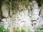
Compton Bassett is known principally for two areas of geology. The chalkstone on the upper areas of Roach and the Marlborough Downs and the sand and gravel which is extracted and backfilled with landfill to the east of Calne.
The chalkstone has been used as the building material for much of the older dwellings of the parish and has created the picture postcard images of white stone cottages the the village has bercome famed for.
The gravel and sand is of the highest quality silica sand and is used extensively for building and road construction across the coutry. The sand's value and the large deposits around Compton Bassett and Calne have been a source of local controversy since extraction first began. Fuelled particularly by the following landfill.
Calne lies at the western edge of the Marlborough Downs, where the scarp of the downs runs north-east and southwest. Calstone's land, south-east of the town, is almost entirely chalk, includes much downland, and reaches 262 m. North-west of the scarp the land continues to fall north-westwards, and Upper Greensand, Gault, Lower Greensand, Kimmeridge Clay, Upper Calcareous Grit, Coral Rag, and Lower Calcareous Grit outcrop in roughly north-east and south-west bands. The river Marden rises below the scarp, flows north-westwards, and is joined by River's brook and Abberd brook from the east, Cowage brook and Fisher's brook from the north, and a stream from the south. The stream joining the Marden from the south may have been called the Sambourne in the 13th century and was later called the Whetham stream. It has cut a deeper valley than the other streams and has exposed Oxford Clay. The Marden and all the streams have deposited strips of alluvium.
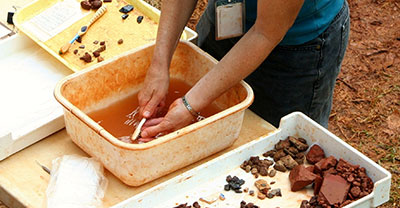
There are prehistoric remains on the chalk downs of Calstone, but few on the clay and sandy soils elsewhere in the area. On land transferred from Calne to Cherhill in 1934, there is a site of Mesolithic settlement. The site was reused in the Neolithic period and, as part of Cherhill village, in 1967. A Bronze-Age grave was found north-west of Calne church. Two sites south-east of Sandy Lane and on or near the course of the Roman road between London and Bath have been identified as possibly that of Verlucio, a Roman settlement probably important as a trading centre or posting station. Remains of three Roman villas have been found north-east of Sandy Lane, one less than 1 km. north of the sites supposed to be Verlucio's, one near Bowood House, and one near Studley bridge.